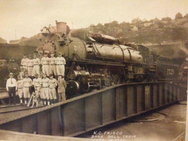
4-8-2 1529 at Kansas City, Missouri on June 15, 1930.

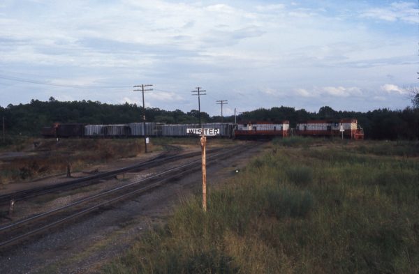
GP7s 587 and 601 at Wister, Oklahoma in October 1974.
Wister, Oklahoma, mile post 453.0, is on the Arthur Subdivision of the Central Division. The subdivision extended from Fort Smith, Arkansas (MP 415.4) southwest through Hugo, Oklahoma (MP 559.0) to Paris, Texas (MP 583.8).
The train is southbound passing over the C.R.I.P. crossing at grade at MP 453.0. In the distance beyond the cab of GP7 601, in the northeast quadrant of the crossing, is the upper portion of the gate protecting the diamond. The normal position of the gate is against the Frisco’s subdivision. After the train clears the crossing, the crew will close and lock the gate back against the Frisco.
Beside the cab of GP7 587 is the Frisco’s station sign. The former joint agency depot once stood just to the north on the southwest quadrant of the diamond crossing. The SLSF/CRIP interchange track is visible curving to the left. Note the on the telegraph post with the three white stripes the interchange’s white waybill exchange box. The curving street on the far left of the image is Pawnee Road.
That successor railroad severed the subdivision as a through route 1981. It abandoned the 88.6 mile segment over the Kiamichi Mountains from Wister south to Antlers in 1981. In 1985 the railroad abandoned the 8.5 mile segment from Wister north to Poteau. Today a portion of the former Frisco right of way in Le Flore County is preserved as the Old Frisco Trail. This is a 6.5 mile walking, running and biking path extending from Poteau south to Wister.
The photograph was taken from very near the street grade crossing with Plum Street. It is looking southeast down the right of way of the Chicago, Rock Island and Pacific (CRIP) Railroad. This line was originally constructed by the Choctaw Coal and Railway Company/Choctaw, Oklahoma and Gulf (CO&G) Railroad. This east/west line extended from Memphis, Tennessee to Amarillo, Texas. That line came under the control of the Rock Island in 1902 and was merged into the system on January 1, 1948.
Today, this segment of the former Rock Island’s Choctaw Route is operated by the Arkansas–Oklahoma Railroad (AOK). This segment extends westward from Howe, Oklahoma to McAlester, Oklahoma. On the east they connect with the Kansas City Southern (KCS), to the west they interchange with the Union Pacific (UP). Further west they operate a disconnected segment of the same line from Shawnee to Oklahoma City.
The view is looking southeast.
Special thanks to Mark Davidson.